 |
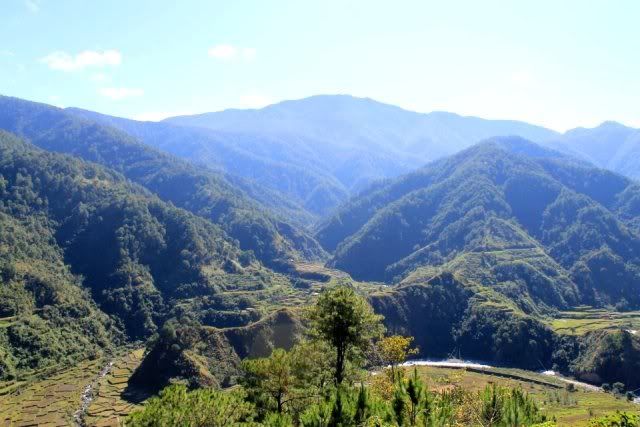
| view from the Halsema highway |
Showing posts with label itinerary. Show all posts
Showing posts with label itinerary. Show all posts
Feb 3, 2012
Mt. Kalawitan : Itinerary and Expenses

Dec 31, 2011
Mt. Balatukan : Itinerary
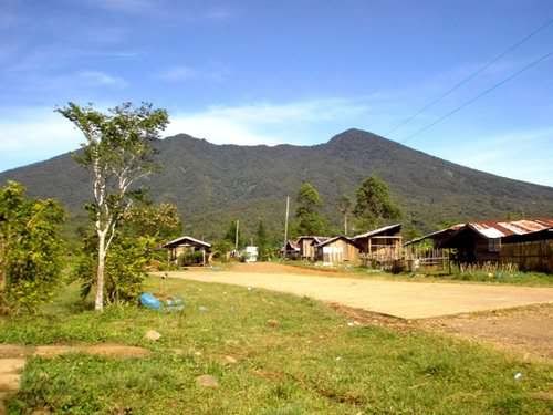 |
| View from Sitio Civoleg: Pamalihi peak (false summit) to the rightmost |
Mt. Balatukan forms one of the gargantuan ranges that pillars Misamis Oriental. This strato-volcano has an estimated elevation of 2,450masl (Wikimapia) and is considered as the highest peak in Misamis Oriental looming over the whole Gingoog City and nearby towns along the National Highway. The summit is called Rosas Pandan Peak, and there is an adjacent prominent peak the locals refer to as Pamalihi peak.
Sep 25, 2011
Itinerary: Mt. Talomo
There were two known trails in Mt. Talomo, the Baracatan trail and the Tamayong trail. Before my climb in Mt. Talomo, I have heard only of the Tamayong trail. It is where the true summit is. However upon research, I was invited to climb the Baracatan side, with the Baracatan peak as the highest point, just across the Tamayong peak. Here are my collections of notes on the two trails.

Aug 20, 2011
Itinerary: Mt. Amuyao (Barlig-Barlig)
It was supposed to be a very nice, long weekend. But thanks to Typhoon Mina, it was devastation for our countrymen up north, and botched vacation plans for most. Though this climb was conceptualized in less than a month before the actual trip, we were almost prepared for this...cancellation was a bit disheartening. I originally intended to do a backtrail chillax climb, whilst my companion will pursue a traverse. Here is a sample IT of my botched trip (I will post on a separate entry the traverse itinerary).
MT. AMUYAO LONG WEEKEND
Barlig-Barlig
August 26-29, 2011
Day 0 Friday
1930 Meetup at Cable Bus terminal (near St. Lukes in Cubao, QC)
2030 ETD Cubao to Bontoc

Day 1 Saturday
0800 ETA Talubin junction, wait for jeep
0900 ETD for Barlig
1100 ETA Barlig, rest, quick lunch, secure guide
1200 Start trek of Monkelat trail
1500 ETA Mt. Polis summit
1630 ETA Barlig viewpoint
1800 ETA Mt. Amuyao summit, prepare dinner
2300 Lights off

Trails:
1. Awa rice field
2. Stairway to Mt. Alemmona (1800masl)
3. Stairway to Mt. Polis (2000masl)
4. Mossy forest to Lifod/Tochor
5. Barlig Viewpoint at 2200masl
6. Mossy forest leading to Amuyao Knife Edge
Reverse IT
Day 2 Sunday
0600 Wakeup call, cook breakfast
0700 Breakfast, explore area, laze around
1100 Cook lunch
1200 Lunch, rest afterwards, explore the area
1300 Socials to sawa
1700 Prepare dinner
1800 Dinner
1900 Socials ulit
2300 Lights off

Day 3 Monday
0530 Wakeup call, cook breakfast and packed lunch
0600 Breakfast and breakcamp
0700 Start trek
1200 ETA Barlig, lunch and washup
1330 ETD Barlig to Talubin junction
1530 ETA Talubin junction
1545 ETD Talubin to Manila via Cable Bus Tours

Day 4 Tuesday
0300 ETA Manila

Jun 17, 2011
ITINERARY: CATARMAN TRIP
Experiencing Northern Samar for the first time… in just one day.
June 18-19, 2011
Day 1 Saturday June 18
0315 ETD Guadalupe
0330 ETA Airport
0545 ETD Manila via Cebpac
0740 ETA Catarman
0800 ETA GV Hotel, check-in
0815 ETD GV Hotel for Lavezares
0915 ETA Lavezares, ride pumpboat to Biri (php50)
1030 ETA Biri, roam the area
1300 ETD Biri
1400 ETA Lavezares
1500 ETA Catarman town proper, explore the area
1800 Dinner
1900 Back at hotel, prepare the Dumaguete trip itinerary
Day 2 Sunday June 19
0600 ETA airport
0740 ETD Catarman to Manila
0915 ETA Manila Domestic
1000 ETA Guadalupe
BUDGET: 1.5k-2k
Plane tickets were acquired via CebPac on sale, purchased last August 2010 for less than Php400 roundtrip.
June 18-19, 2011
Day 1 Saturday June 18
0315 ETD Guadalupe
0330 ETA Airport
0545 ETD Manila via Cebpac
0740 ETA Catarman
0800 ETA GV Hotel, check-in
0815 ETD GV Hotel for Lavezares
0915 ETA Lavezares, ride pumpboat to Biri (php50)
1030 ETA Biri, roam the area
1300 ETD Biri
1400 ETA Lavezares
1500 ETA Catarman town proper, explore the area
1800 Dinner
1900 Back at hotel, prepare the Dumaguete trip itinerary
Day 2 Sunday June 19
0600 ETA airport
0740 ETD Catarman to Manila
0915 ETA Manila Domestic
1000 ETA Guadalupe
BUDGET: 1.5k-2k
Plane tickets were acquired via CebPac on sale, purchased last August 2010 for less than Php400 roundtrip.
May 28, 2011
The Batanes Series
I went back to Manila with the fruit of my material investments for the Batanes trip. I promised myself to write as much as I can about this beautiful place that gave me a new lease on life. My attention were diverted to other things hence the long list of blog backlogs for my Batanes Series.

BATANES HOLYWEEK TRIP
Itinerary and Expenses
How We Ate Our Way Through the 7-Day Stay
Homeward Bound
BATANES HOLYWEEK TRIP
Itinerary and Expenses
How We Ate Our Way Through the 7-Day Stay
Homeward Bound
Apr 11, 2011
Itinerary: Mt. Balagbag
 |
| ^^^misinformation there: balagbag is not entirely on SJDM |
Mt. BALAGBAG
Bulacan-Rizal
Jump-off points: Karahume and Licao-Licao
Estimated elevation: 600-650masl.
Estimated expenses: Around 200-300php if within Manila and EDSA accessible areas. Safe budget is 500php
Expense breakdown:
Bus to Tungko - Php60-70.00
Jeep to either Licao or Karahume - Php28.00
Registration - php5.00
Jeep back to Tungko - P28.00
Bus to EDSA - Php60-70.00
Somewhere in Bulacan and Rizal lies one of the gateway to one of the last Philippine frontier the Sierra Madre range. This open-trailed “more-of-a-hill-than-a-mountain” destination has several entry and exit points. So far I have only tried 4 of these trails which basically traces the road taken by maguulings down to Licao-licao and Karahume area.
HOW TO GET THERE:
From Guadalupe EDSA, a bus with TUNGKO signage will take you around 1-2 hour ride with the fare going between Php50-70. Alight at the gas station terminal. Walk back a few meters to reach the Licao-licao jeep terminal. There’s a nearby market where you can buy things you will need like umbrella and packed food. The jeep ride to Licao-licao terminal is 30-45minutes, costing P25-28. The fare depends on your jumpoff for the ascent, since you can opt to alight to Karahume, a few hundred meters away from the Licao-licao terminal.
There’s also a way from Rizal, as there are trips to Montalban in Licao-licao jeep terminal.
You can take a tricycle ride upto the San Isidro checkpoint for Php70 per trip. This will cut your trek time in half. There are trip schedules here, if you happen to miss the last trip, you can ride a tricycle all the way to the Tungko-Norzagaray highway.
Mar 31, 2011
Mt. Banoy Traverse Itinerary
 |
| four towers and the road to traverse |
Mt. BANOY TRAVERSE
(Talumpok Silangan-Balatbat)
Suggested Itinerary
Day 1
0930 ETD Cubao bus terminal to Batangas City (php175)
1200 ETA Bolbok Junction/Diversion, lunch
1230 Ride jeep to town proper, alight on Goto King (php8)
1245 ETA Goto King, walk to terminal for Dagatan
1315 ETA terminal, ride jeep bound for Dagatan (php25)
1345 ETA "Siko/Piko(?)". Ride tricycle to Brgy. Health center(Php20each). Register (no fees being collected)
1400 Start trek on rough road trail
1430 ETA Sitio Banoy
1445 ETA viewdeck
1500 ETA campsite (left of the rough road), pitch tent
1530 Start assault to towers/wireless
1540 ETA towers/wireless, explore the area
1730 Cook dinner
2300 Lights off
Day 2 (not yet tested, suggested only)
0600 Wake-up call, prepare breakfast and breakcamp
0700 Start descent
1330 ETA small waterfalls
1500 ETA jumpoff "chapel"
1530 ETD to Bolbok junction/Diversion
1630 ETA Bolbok junction/Diversion, bus back to Manila
1830 ETA Manila
Notes:
- the traverse on Day 2 has never been tried, only the ascent trail via Talumpok Silangan.
- on our way home, we didn't go back to town proper, we just head straight to Star Tollway. if you know how to commute to Dagatan, then just cut the trip short and alight at Star Tollway instead of heading to Diversion Road near the port.
- there's watersource near campsite. be mindful when getting water as it also supplies the nearby sitios.
- people here are very friendly so don't hesitate to ask or answer their questions.
Feb 27, 2011
THE IGBARAS TRIO: A Personal Challenge
Up north, there’s what they call the “Bakun Trio”. They are 3 notable mountains that are proximate with each other, them being Mts. Tenglawan, Kabunian and Lobo in Bakun, Benguet. Bakun Trio climb is usually done by climbing these 3 mountains successively, either by (1) dayhikes with Brgy. Poblacion as basecamp or via (2) camping on mountain grounds and traversing each mountains. You can read my Bakun Trio climb report here.
 |
| Igbaras mountain range: eastern view from Igcabugao basecamp |
Feb 20, 2011
Iloilo Trip 2011: Mt. Taripis Climb plus Sidetrip Itinerary
 |
| road less travelled: mt taripis taken during napulak climb |
Dec 21, 2010
Marinduque: Year-End Climb Trip
Every sensible traveller prepares an itinerary of the trip beforehand to ensure that resources and time will be maximized to fully enjoy the experience. This ideal itinerary I prepared does not promise a foolproof adventure plan, but rather will serve as my guide as I travail the depths of the island.
You might be a bit surprised with the dates in this itinerary. And I am sorry to my mother who kept on wishing to ground me if only for this Christmas. Don't worry Ma, I will be on the ground for New Year.
I hope this post will help other future travelers of this wondrous place.
Subscribe to:
Posts (Atom)