 |
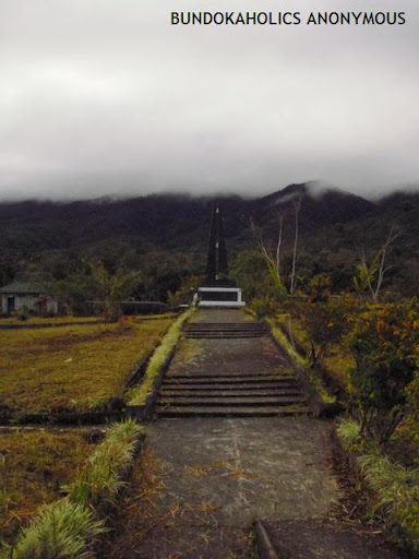
| The shrine silently waiting for visitors... |
This post was inspired by a trip to Brgy. Lunotan during Undas 2011, a place cradled by Gingoog mountains such as Mt. Balatukan range and Mt. Sumagaya range. I managed to climb Mt. Balatukan up to the summit, termed as Rosas Pandan Peak by local mountaineering group KAPLAG. I am also scheduled to climb Mt. Lumot, the site of the horrific plane crash, and one of the most deadly accident in the Philippine aviation history. But due to realization that the climb will prove to be a very strenuous dayhike, I just visited the Flight 387 Shrine in Sitio Harrohay, and will return for the Mt. Lumot-Mt.Sumagaya traverse next year.
Various recounts of the incident was also heard from the locals of San Isidro, who were among the volunteers. It was told that on the night of the incident, a loud thunderclap was heard. It was only after a day that they were told of the crash. Some went to Mt. Balatukan, some went to Mt. Sumagaya. In all urgency, they failed to pack the basic needs of food and water. The blogger was also told of the gruesome scene at the impact site, with innards and body parts hanging from everywhere. The place stank of rotten flesh.
What was sad was that some of the local rescuers gathered souvenirs of that fateful event, may it be the engine, the foams, baggages, cashboxes, among others. They have various reasons for doing so. In the blogger's opinion, the personal belongings should have been respected and given back to the respective relatives.
My Disastrous Moments - CebPac Flight 387
by: Jess Dureza
EPISODE ONE. (Cebu Pacific Flight 387 plane crash, February 1998) Indeed, it might be really coincidental but I can clearly recall my first day of assumption into office and the string of calamities and disasters that followed. I remember that I was directed to proceed to Tacloban, Leyte where FVR was meeting with his cabinet then. Upon arrival at the cabinet meeting venue, I noticed that the president was in a serious huddle with Jomag ( General Jose Magno), one of his close aides in a corner. Then he called for me and simply said: “ Jess, good you are here. Go to Cagayan de Oro now. There’s a plane crash there.” Then he convened his cabinet while I left in a huff missing to attend what was supposed to be my first official cabinet meeting. I boarded a waiting Huey helicopter which flew me across the channel to Mactan, Cebu where I caught the first available plane to Lumbia Airport in Cagayan de oro City. I did not have any inkling that this day was to be the beginning of a long, grim and harrowing experience as crisis manager of Cebu Pacific’s tragic “Flight 387”.
* * *
ONLY BODY PARTS -- The task was not only to manage the recovery and retrieval operations of dead bodies –or more precisely, body parts – as there were no intact bodies to speak of considering the fact that the aircraft slammed the mountainside of Mt Sumagaya in Sitio Lumot about 5,000 feet above sea level. Volunteers and rescue teams had to even climb tree tops to pick up parts of bodies, flesh hanging by branches. There were no intact bodies to speak of. The work included dealing with the distraught and angry families.
Then bringing down body bags by choppers that had to hover over tree tops with buffeting winds at perilous high altitude, as there were no landing sites on the steep hillside. I remember one American representative of an investigating team who flew with me in one hop to the site and back in those conditions. He told me: “Sir, I was a Huey pilot in Vietnam before but we could not do what your young Air Force Huey pilots just did today.”
The Air Force, Army, PNP, the search and rescue teams, media, the kibitzers, the public coming in all shapes -- everybody had to be managed and coordinated. Then the grim task of trying to put together and identifying detached body parts, flesh, belongings, etc.
* * *
CEBU PAC’S “SHINING MOMENT” --The whole Cebu Pacific and other Gokongwei facilities converged in what was described paradoxically as the airline’s “shining moment” in the face of a tragedy. Then young Lance Gokongwei, freshly taking over the family’s burgeoning business empire, flew down to Cagayan de Oro City and from there marshaled what was to be the biggest humanitarian offensive of a company. It was my own baptism of fire as Mindanao official. So it was for Lance who just came home from schooling abroad to preside over a tragedy.
I recall all Cebu Pac facilities nationwide were closed, all aircrafts grounded and everyone from pilots to flight attendants, office workers, to janitors all swooped down and encamped for days and weeks in Cagayan de Oro in an effort to all help. Every family victim was assigned assistants to take care of all needs to help assuage the pain and agony of losing loved ones.
* * *
“SHIT SESSIONS” -- I had my own moments of agony. As crisis manager, I held twice daily briefings on what was happening in the search and rescue operations. For several days, families had to be content with reports only due to the difficult terrain and retrieval constraints. Of course, this did not sit well with many of them. We were cursed, insulted, embarrassed during these briefing sessions, many demanding why the delay, why bodies were not yet brought down, etc. Understanding what the relatives were going through, after the first briefing session, I opened the next one announcing: “Before I give you the latest reports, let’s start with a “Shit Session”. Go ahead and shit all of us here then we proceed.” It worked. After that emotions were contained somehow every time I would meet with them for the latest updates.
* * *
ARMED MEN ---One incident stood out. When the small pieces of body parts in the National Power Corp hangar at Lumbia airport, which was converted into a huge morgue, started to pile up in body bags, one jeepload of armed Muslims from Lanao came and demanded that they retrieve their relative’s remains. They became belligerent when they were told we could not do it because the bodies could not be identified and there were no intact parts to go by. I was called to face them and explain but they were still adamant and threatening with their firearms. In my frustration, I called for the leader of the group, asked what was the body weight of their victim. When he said about 150 pounds, I led him inside the hangar, pointed to the bits and pieces that were being classified and processed for DNA identification. Then I told him to go ahead and weigh 150 lbs from some of those in the stockpile to bring home, if he would insist. When he saw the real situation, he piped down and left in a huff.
The effort was so done that I told Lance, after we closed shop with memorial services at the Oro Gardens where the remains of more than 100 lost passengers were interred that the bonding, the collective effort and the achievement of surviving the trauma that everyone went through made Cebu Pacific a better airline. I am only surmising now but what the airline has achieved over these years and what it is today can probably be traced somehow to that spirit that welded the whole team for more than a month in Cagayan de Oro and its environs attending to a tragedy.
What the public perhaps does not know is that every first week of February, to this day, orphaned families make it a point to either re-visit the sites, do memorial services, mark milestones like birthdays, etc and Cebu Pacific quietly stands by every family with the same support as it did some 13 years ago.
“BLACK BOX” – One of my primary concerns during the search and retrieval operations (no longer search and RESCUE but retrieval, as it was evident early on that there were no survivors to rescue) was searching for the so-called “Black Box”. All aircrafts, by the way, are fitted with this instrument, which records all data pertinent to that flight from engine condition to every information including voice recording of conversations in the cockpit. It is a flight data recorder of sorts, sturdily made and reinforced to withstand any tremendous shock of a plane crash. In the case of Flight 387, it took us several days to locate the “Black Box” from the wreckage. The airline immediately sent the “orange colored” instrument to some facility abroad (evidently the manufacturer of the aircraft engine) for decoding. An interesting note: “Black Box” is a misnomer because they were usually colored or painted orange for easy recovery.
After a few days, I got word that the data contained in that black-but-orange box were intact and successfully decoded. I was able to read the transcript of the recording. I also listened to the voice recording of the conversation between the pilot and the co-pilot during those fateful final seconds of Flight 387.
‘OFF AIRWAYS” ROUTE --Flight 387 took off from Manila bound for Lumbia Airport in Cagayan de Oro city. Instead of going straight to Lumbia, the plane made a brief stop at an airport along the way to drop some mechanics or spare parts for another Cebu Pac plane undergoing repairs there. After a quick stopover, it took off again for Lumbia and since it was not the direct route due to the side trip, it travelled “off airways” meaning, it did not use the “highway” in the air that Manila-to-Lumbia flights normally took. This, by the way, was not against regulations as the flight had filed with authorities and got approval for a flight plan for that side trip. So, instead of approaching Cagayan de Oro from the sea, Flight 387 crossed over Butuan, flying inland and directly in its path was Mt. Sumagaya, MORE THAN 5,000 feet in elevation. That mountain , by the way, had been graveyards of previous other aircrafts, notable of which was the small shuttle plane used then by former AFP Chief of staff and presidential candidate Rene de Villa. (Of course, “Manong” Rene was not on board when the aircraft disappeared in one fateful flight.) From accounts, Mt. Sumagaya was almost always blanketed with clouds during that time of the year. As soon as they passed over that point, aircrafts approaching for landing at Lumbia would start descending. The so-called “landing plate” or reference point for approaching aircrafts start from there and they commence their descent from that point, usually at 5,000 feet.
* * *
ZERO VISIBILITY -- From my recollections if I start reconstructing what happened inside the cockpit from what I heard in the recording, Flight 387 entered thick clouds as it passed through the area of Mt. Sumagaya. At visibility zero, I could hear the co-pilot saying to the pilot: “May bundok yata sa area na ito, Sir”. Or words to that effect. Then I could hear the sound of ruffles and shuffling of papers, evidently, the person was probably checking on the ATO map for elevation check or doing his routine flight manual checklist. A pilot’s voice was heard saying: “Leveling at 5,000”. A few seconds later, suddenly a shrill electronic voice from the aircraft’s computer started shouting: “Terrain, terrain. Pull up; pull up, woof, woof! ” THEN TOTAL AND DEAD SILENCE. Those were to be the final moments.
* * *
OBSERVATIONS --On what transpired, I have a layman’s observation – or critique, if you may-- to make, although to some this may not be welcome considering that many of us, most especially the airline, families of the pilots and crew and the ill-fated passengers have already moved on and have left those tragic moments behind them. But I’ll take that chance.
PILOT ERROR?--For one, I was made to understand that pilots had to maintain visibility all throughout as they approached for landing, especially from the so-called “landing plate”. In other words, they had to fly above the clouds, maintaining full visibility up to the airport vicinity. In the case of Flight 387, the pilots entered the zero visibility zone as they approached. I was also told later by someone that when flights are “off airways” and therefore usually not as closely tracked by the control center as those “along airways”, they had to do visibility flying and not enter thick clouds. Why the Flight 387 young and former Air Force pilots did otherwise could not be explained.
* * *
ERRONEOUS ATO MAP --Secondly, I checked the standard ATO map used by pilots at that time and I was shocked to see that the elevation indicated in the spot of Mt. Sumagaya in that map was not an accurate elevation data: I found a lesser elevation number in the map than its actual height. At zero visibility flying, an erroneous ATO map could be misleading to pilots believing that they were still safely above the highest point when in fact they were in a collision course with the terrain ahead. Then that “landing plate” indicator in the map was just in the vicinity of Mt. Sumagaya. That could explain why Flight 387 pilots probably thought they were still safe maintaining 5,000 feet altitude en route to Lumbia unaware that they were flying right smack into the waiting hillside at a cruising speed. I also gathered then that pilots had to maintain at least 10 percent altitude allowance from the highest elevation en route. In other words, if the pilots were knowingly cruising at 5,000 altitude, their calculation was that the highest elevation in the area was at 4,500 feet more or less. But then again, Mt. Sumagaya was tragically more than 5,000 ft.!
That could probably also explain why other smaller aircrafts went confidently cruising in zero visibility in that same route and ending up slamming on the same mountainside.
* * *
ALMOST MAKING IT! – When I visited the wreckage site of the aircraft during our operations, I was almost dumbfounded. The aircraft almost made it. It hit the top most ledge of the mountainside, almost clearing the highest point by only a few feet. Almost but not quite! In fact, some of the wreckage and body parts were recovered from the other side of the ledge. I could picture in my mind the futile attempt of pilots to “pull up, pull up” the plane’s control levers as dictated by the computers at the last moments. During my last flyover by helicopter weeks after the accident over the area, I re-named the site as “Mount 387”. To this day, a memorial site still stands at Ground Zero.
* * *
SOMEONE GOOFED? --A final point I HAVE to disclose here. Although this is not the first time I made this public. I got curious again sometime long after that incident and looked again at a REVISED ATO map and I noticed there was a change or rectification of that elevation data in the Mt. Sumagaya area. I got some shivers thinking my suspicions were validated: that some mistake in the previous maps had been indeed found. And quietly rectified. Well and good. That would prevent similar accidents in the future. But don’t you think we owe it to all those lost lives to pin some responsibility to whoever goofed? And prevent similar tragic mistakes to unnecessarily take away precious lives? Just thinking aloud.
* * *
ONLY BODY PARTS -- The task was not only to manage the recovery and retrieval operations of dead bodies –or more precisely, body parts – as there were no intact bodies to speak of considering the fact that the aircraft slammed the mountainside of Mt Sumagaya in Sitio Lumot about 5,000 feet above sea level. Volunteers and rescue teams had to even climb tree tops to pick up parts of bodies, flesh hanging by branches. There were no intact bodies to speak of. The work included dealing with the distraught and angry families.
Then bringing down body bags by choppers that had to hover over tree tops with buffeting winds at perilous high altitude, as there were no landing sites on the steep hillside. I remember one American representative of an investigating team who flew with me in one hop to the site and back in those conditions. He told me: “Sir, I was a Huey pilot in Vietnam before but we could not do what your young Air Force Huey pilots just did today.”
The Air Force, Army, PNP, the search and rescue teams, media, the kibitzers, the public coming in all shapes -- everybody had to be managed and coordinated. Then the grim task of trying to put together and identifying detached body parts, flesh, belongings, etc.
* * *
CEBU PAC’S “SHINING MOMENT” --The whole Cebu Pacific and other Gokongwei facilities converged in what was described paradoxically as the airline’s “shining moment” in the face of a tragedy. Then young Lance Gokongwei, freshly taking over the family’s burgeoning business empire, flew down to Cagayan de Oro City and from there marshaled what was to be the biggest humanitarian offensive of a company. It was my own baptism of fire as Mindanao official. So it was for Lance who just came home from schooling abroad to preside over a tragedy.
I recall all Cebu Pac facilities nationwide were closed, all aircrafts grounded and everyone from pilots to flight attendants, office workers, to janitors all swooped down and encamped for days and weeks in Cagayan de Oro in an effort to all help. Every family victim was assigned assistants to take care of all needs to help assuage the pain and agony of losing loved ones.
* * *
“SHIT SESSIONS” -- I had my own moments of agony. As crisis manager, I held twice daily briefings on what was happening in the search and rescue operations. For several days, families had to be content with reports only due to the difficult terrain and retrieval constraints. Of course, this did not sit well with many of them. We were cursed, insulted, embarrassed during these briefing sessions, many demanding why the delay, why bodies were not yet brought down, etc. Understanding what the relatives were going through, after the first briefing session, I opened the next one announcing: “Before I give you the latest reports, let’s start with a “Shit Session”. Go ahead and shit all of us here then we proceed.” It worked. After that emotions were contained somehow every time I would meet with them for the latest updates.
* * *
ARMED MEN ---One incident stood out. When the small pieces of body parts in the National Power Corp hangar at Lumbia airport, which was converted into a huge morgue, started to pile up in body bags, one jeepload of armed Muslims from Lanao came and demanded that they retrieve their relative’s remains. They became belligerent when they were told we could not do it because the bodies could not be identified and there were no intact parts to go by. I was called to face them and explain but they were still adamant and threatening with their firearms. In my frustration, I called for the leader of the group, asked what was the body weight of their victim. When he said about 150 pounds, I led him inside the hangar, pointed to the bits and pieces that were being classified and processed for DNA identification. Then I told him to go ahead and weigh 150 lbs from some of those in the stockpile to bring home, if he would insist. When he saw the real situation, he piped down and left in a huff.
The effort was so done that I told Lance, after we closed shop with memorial services at the Oro Gardens where the remains of more than 100 lost passengers were interred that the bonding, the collective effort and the achievement of surviving the trauma that everyone went through made Cebu Pacific a better airline. I am only surmising now but what the airline has achieved over these years and what it is today can probably be traced somehow to that spirit that welded the whole team for more than a month in Cagayan de Oro and its environs attending to a tragedy.
What the public perhaps does not know is that every first week of February, to this day, orphaned families make it a point to either re-visit the sites, do memorial services, mark milestones like birthdays, etc and Cebu Pacific quietly stands by every family with the same support as it did some 13 years ago.
“BLACK BOX” – One of my primary concerns during the search and retrieval operations (no longer search and RESCUE but retrieval, as it was evident early on that there were no survivors to rescue) was searching for the so-called “Black Box”. All aircrafts, by the way, are fitted with this instrument, which records all data pertinent to that flight from engine condition to every information including voice recording of conversations in the cockpit. It is a flight data recorder of sorts, sturdily made and reinforced to withstand any tremendous shock of a plane crash. In the case of Flight 387, it took us several days to locate the “Black Box” from the wreckage. The airline immediately sent the “orange colored” instrument to some facility abroad (evidently the manufacturer of the aircraft engine) for decoding. An interesting note: “Black Box” is a misnomer because they were usually colored or painted orange for easy recovery.
After a few days, I got word that the data contained in that black-but-orange box were intact and successfully decoded. I was able to read the transcript of the recording. I also listened to the voice recording of the conversation between the pilot and the co-pilot during those fateful final seconds of Flight 387.
‘OFF AIRWAYS” ROUTE --Flight 387 took off from Manila bound for Lumbia Airport in Cagayan de Oro city. Instead of going straight to Lumbia, the plane made a brief stop at an airport along the way to drop some mechanics or spare parts for another Cebu Pac plane undergoing repairs there. After a quick stopover, it took off again for Lumbia and since it was not the direct route due to the side trip, it travelled “off airways” meaning, it did not use the “highway” in the air that Manila-to-Lumbia flights normally took. This, by the way, was not against regulations as the flight had filed with authorities and got approval for a flight plan for that side trip. So, instead of approaching Cagayan de Oro from the sea, Flight 387 crossed over Butuan, flying inland and directly in its path was Mt. Sumagaya, MORE THAN 5,000 feet in elevation. That mountain , by the way, had been graveyards of previous other aircrafts, notable of which was the small shuttle plane used then by former AFP Chief of staff and presidential candidate Rene de Villa. (Of course, “Manong” Rene was not on board when the aircraft disappeared in one fateful flight.) From accounts, Mt. Sumagaya was almost always blanketed with clouds during that time of the year. As soon as they passed over that point, aircrafts approaching for landing at Lumbia would start descending. The so-called “landing plate” or reference point for approaching aircrafts start from there and they commence their descent from that point, usually at 5,000 feet.
* * *
ZERO VISIBILITY -- From my recollections if I start reconstructing what happened inside the cockpit from what I heard in the recording, Flight 387 entered thick clouds as it passed through the area of Mt. Sumagaya. At visibility zero, I could hear the co-pilot saying to the pilot: “May bundok yata sa area na ito, Sir”. Or words to that effect. Then I could hear the sound of ruffles and shuffling of papers, evidently, the person was probably checking on the ATO map for elevation check or doing his routine flight manual checklist. A pilot’s voice was heard saying: “Leveling at 5,000”. A few seconds later, suddenly a shrill electronic voice from the aircraft’s computer started shouting: “Terrain, terrain. Pull up; pull up, woof, woof! ” THEN TOTAL AND DEAD SILENCE. Those were to be the final moments.
* * *
OBSERVATIONS --On what transpired, I have a layman’s observation – or critique, if you may-- to make, although to some this may not be welcome considering that many of us, most especially the airline, families of the pilots and crew and the ill-fated passengers have already moved on and have left those tragic moments behind them. But I’ll take that chance.
PILOT ERROR?--For one, I was made to understand that pilots had to maintain visibility all throughout as they approached for landing, especially from the so-called “landing plate”. In other words, they had to fly above the clouds, maintaining full visibility up to the airport vicinity. In the case of Flight 387, the pilots entered the zero visibility zone as they approached. I was also told later by someone that when flights are “off airways” and therefore usually not as closely tracked by the control center as those “along airways”, they had to do visibility flying and not enter thick clouds. Why the Flight 387 young and former Air Force pilots did otherwise could not be explained.
* * *
ERRONEOUS ATO MAP --Secondly, I checked the standard ATO map used by pilots at that time and I was shocked to see that the elevation indicated in the spot of Mt. Sumagaya in that map was not an accurate elevation data: I found a lesser elevation number in the map than its actual height. At zero visibility flying, an erroneous ATO map could be misleading to pilots believing that they were still safely above the highest point when in fact they were in a collision course with the terrain ahead. Then that “landing plate” indicator in the map was just in the vicinity of Mt. Sumagaya. That could explain why Flight 387 pilots probably thought they were still safe maintaining 5,000 feet altitude en route to Lumbia unaware that they were flying right smack into the waiting hillside at a cruising speed. I also gathered then that pilots had to maintain at least 10 percent altitude allowance from the highest elevation en route. In other words, if the pilots were knowingly cruising at 5,000 altitude, their calculation was that the highest elevation in the area was at 4,500 feet more or less. But then again, Mt. Sumagaya was tragically more than 5,000 ft.!
That could probably also explain why other smaller aircrafts went confidently cruising in zero visibility in that same route and ending up slamming on the same mountainside.
* * *
ALMOST MAKING IT! – When I visited the wreckage site of the aircraft during our operations, I was almost dumbfounded. The aircraft almost made it. It hit the top most ledge of the mountainside, almost clearing the highest point by only a few feet. Almost but not quite! In fact, some of the wreckage and body parts were recovered from the other side of the ledge. I could picture in my mind the futile attempt of pilots to “pull up, pull up” the plane’s control levers as dictated by the computers at the last moments. During my last flyover by helicopter weeks after the accident over the area, I re-named the site as “Mount 387”. To this day, a memorial site still stands at Ground Zero.
* * *
SOMEONE GOOFED? --A final point I HAVE to disclose here. Although this is not the first time I made this public. I got curious again sometime long after that incident and looked again at a REVISED ATO map and I noticed there was a change or rectification of that elevation data in the Mt. Sumagaya area. I got some shivers thinking my suspicions were validated: that some mistake in the previous maps had been indeed found. And quietly rectified. Well and good. That would prevent similar accidents in the future. But don’t you think we owe it to all those lost lives to pin some responsibility to whoever goofed? And prevent similar tragic mistakes to unnecessarily take away precious lives? Just thinking aloud.


