 |
| ^^^misinformation there: balagbag is not entirely on SJDM |
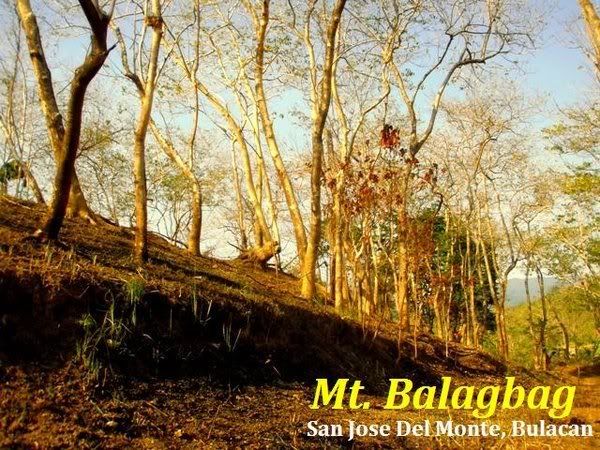
Mt. BALAGBAG
Bulacan-Rizal
Jump-off points: Karahume and Licao-Licao
Estimated elevation: 600-650masl.
Estimated expenses: Around 200-300php if within Manila and EDSA accessible areas. Safe budget is 500php
Expense breakdown:
Bus to Tungko - Php60-70.00
Jeep to either Licao or Karahume - Php28.00
Registration - php5.00
Jeep back to Tungko - P28.00
Bus to EDSA - Php60-70.00
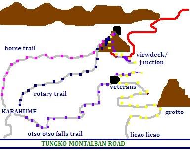
Somewhere in Bulacan and Rizal lies one of the gateway to one of the last Philippine frontier the Sierra Madre range. This open-trailed “more-of-a-hill-than-a-mountain” destination has several entry and exit points. So far I have only tried 4 of these trails which basically traces the road taken by maguulings down to Licao-licao and Karahume area.
HOW TO GET THERE:
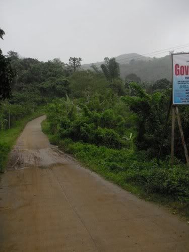
From Guadalupe EDSA, a bus with TUNGKO signage will take you around 1-2 hour ride with the fare going between Php50-70. Alight at the gas station terminal. Walk back a few meters to reach the Licao-licao jeep terminal. There’s a nearby market where you can buy things you will need like umbrella and packed food. The jeep ride to Licao-licao terminal is 30-45minutes, costing P25-28. The fare depends on your jumpoff for the ascent, since you can opt to alight to Karahume, a few hundred meters away from the Licao-licao terminal.
There’s also a way from Rizal, as there are trips to Montalban in Licao-licao jeep terminal.
You can take a tricycle ride upto the San Isidro checkpoint for Php70 per trip. This will cut your trek time in half. There are trip schedules here, if you happen to miss the last trip, you can ride a tricycle all the way to the Tungko-Norzagaray highway.
 |
| licao-licao jeep terminal |
THE TRAILS
 |
| road trail, with mt. bituin grotto at sight |
Licao-licao road trail
From the jeep terminal in Licaolicao, just follow the road trail going to Veterans. Here you will pass by Mt. Bituin grotto and a few houses along the way. This road trail goes all the way to the helipad/campsite. The campsite is very wide and can hold more than 10-15 tents at once.
The first time I went here in March 2009, the road is still intact and a 4X4 truck in good condition can negotiate it to the helipad. Due to the typhoons that ravaged the area, the road is now passable by trucks up to the checkpoint area only.
You can also opt to ride a tricycle to the checkpoint, which will save you around 30minutes to an hour of road trek. The fare is Php70 per trip going there, and it might depend on how heavy your loads are.
At the Veterans, there are mini-grocery stores for your needs. They also sell halo-halo. The cold drinks are only cooler-chilled. You can inquire there on the trail to the waterfalls where you can freshen up a bit after a climb or just enjoy the cool mountain air which is a bit different to the air on the trail to the top which has that warm windy feel.
 |
| from veterans going down:this way to the waterfalls |
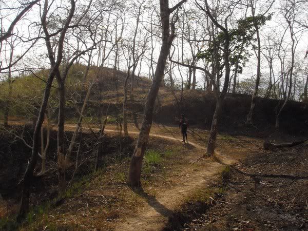
The road trek can be really exhausting if undertaken at high noon, and it is advisable to walk this way near sundown or very early morning. Few tree shades are available. Near the summit, there is a rocky view deck which affords you a greater view of the Sierra Madre mountain ranges. You will have a clear picture of the majectic Mt. Oriod, Mt. Irid from afar, Mt. Maranat nearby, Mt. Siam which resembles a horse saddle, and Mt. Bituin which reminds me of the ridges of Mt. Batulao.
Total estimated time to campsite: 1-2 hours on full pack
Licao-licao to Veterans: 15-30mins
Veterans to campsite: 1-1.5hrs
Waterfalls trail
The famous landmark of Mt. Balagbag is a longshot view of the waterfall at the end of the rivertrek from Karahume. This waterfall is sometimes referred to as Kaytitinga, and the one more famous with the locals is the Otso-otso falls with a large catchbasin for trickling water from the river/falls.
 |
| Kaytitinga falls:water cascades beautifully during wet season |
To take this trail you have to alight to Sitio Karahume. Follow the wide road towards the mountains, and make a right turn to the second street. You will pass by an elementary school before getting to the entrance marked by “THIS WAY TO THE FALLS”.
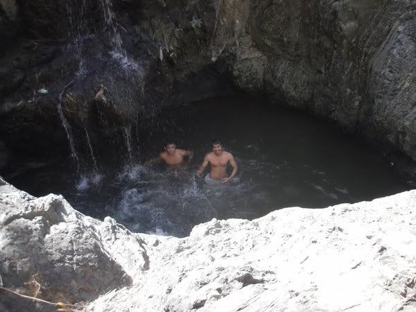 |
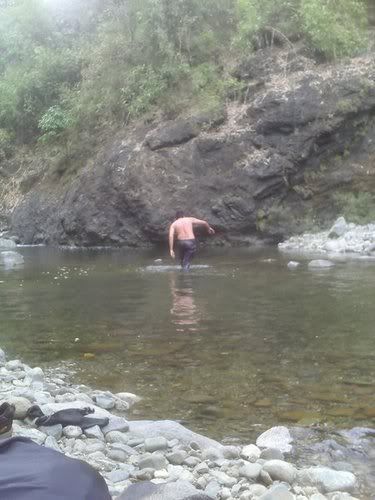
| cooling down @ otso-otso catchbasin |
There’s always confusion as to the name of the waterfalls, for the mountain climber who introduced me to Mt. Balagbag (Jan of Layagtrekkers) named it Kaytitinga falls which is unrecognized by locals when queried. They fondly called it Ocho-ocho falls.
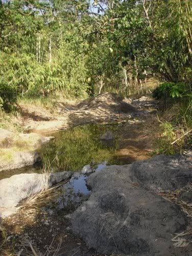
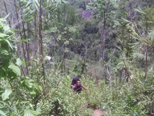
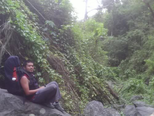
Around 15 minutes from the jump-off, you will start your trek on the sides of a mini-river. In this area, locals bathing and washing clothes are a familiar sight. Don’t forget to extend a warm greeting, as the ground you are treading is part of their domain. You can hop on steady rocks along the side, or you can choose to plough the waters. There are parts were the water can go as shallow as the ankle, and there were parts where they are almost knee-deep to waist-high. At times of dry season, there are just few mini pools of water on the trail instead.
 |
| dried out river |
 |
| river trekking can be stressful at times |
After half an hour of river trekking, you will encounter your first sets of high rocks. This is part of the numerous water cascades of the Kaytitinga Falls. The 1st water falls that you will see along the way is just a mini-water fall drop. The most famous amongst them is the 2nd water falls, which is almost half an hour away from the first water falls. In here, there is a strong current, and a pool of water where you can have a nice cool dip. In taking the 2-day Mt. Balagbag Traverse itinerary, it is advisable to have your lunch here, and you can stay till 2pm for a more relaxing climb. Not far is the 3rd, 4th, and 5th water falls which is merely a long stretch of running water over slanted rocks. In this part, you have to struggle your way up the high rocks of the falls itself. Be careful though as the rocks were slippery. At the last water fall, you will see a trail on the right leading up. This is the part where you will merge with the traditional rough road trail of Mt. Balagbag.
You will exit on the Veterans from the falls trail, ending your river trek and giving way to a grueling rough road hike.
Total estimated hours to campsite on full pack: 3-4 hours
River trekking + waterfalls climbing = 2.5hrs
Veterans to campsite = 1-1.5hrs
Rotary Trail
Karahume is a small sitio nested at the western foot of the mountain range that cradles Mt. Balagbag. It is home to several of the traverse trails including the so-named Rotary trail. It is the same way going to the water falls, but you will not descend to the “falls marker”. Instead, you will continue farther until you reach a small water dam. Make a left turn from the wide trail towards that water dam. From there, the path up is visible, and there are locals you can inquire with since this is also being used by the “mag-uuling”s.
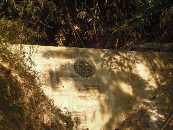 |
| rotary landmark |
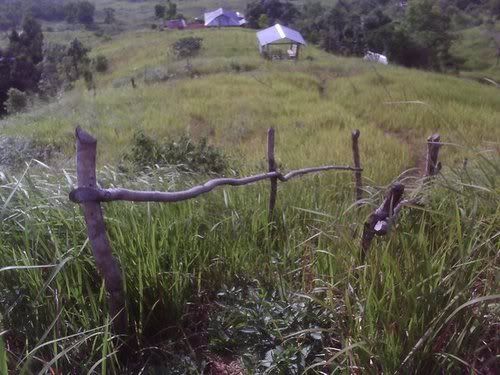
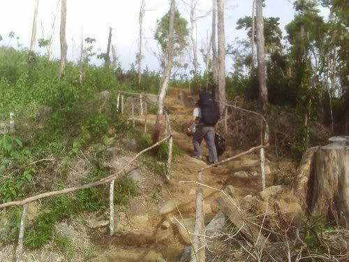
The path here will give you that familiar mountain feel in contrast to the rough road trail. Such is the name of the trail because of a rotary marker early on the hike. The soil is also characterized with a reddish brown hue, which varies depending on season. After one or two hours of assault you will reach the flatland with houses and fences and a diverting pathway. Don’t take the left path for it will lead you deeper into the forest. Instead, follow the trail which will lead you up to the clearing/farm with several houses. Remember, there’s no way but up!
Photo 10
 |
| clearing/grassland: on descent either to rotary or carabao trail |
After negotiating the grassland for about 15-30mins, you will reach several trails going up to the rough road. One of them is an earthen stairway with wooden handles. Mt. Balagbag is a private land and inhabited almost to the campsite so don’t worry about getting lost in the clearing, there are lots of locals you can ask for directions. Just tell them you are going to the helipad.
 |
| red earth flatland |
Total estimated time to campsite: 2-3 hours on fullpack.
Assault to flatland: 1.5-2hrs
Clearing/farm to campsite: 30mins-1hr
Horse trail/Carabao trail
Another forested path to Mt. Balagbag is a hike through the carabao trail. In contrast with the rotary trail, the path here is more gradual and rolling, for it is used by grazing bovines and workload equines.
Instead of going right on the second turn in Karahume, walk straight the wide rough road. There are fewer houses here than with the falls and rotary trail. There’s also a military detachment when we descended from our exploration back in May 2009.
The trail is well established, on higher ground you will encounter a diversion where you need to take the right turn towards the flatland and eventually to the clearing. The trail here is infested with mosquitoes as compared to the others, so be prepared with anti-mosquito lotions. Also, the last time I passed by here (May2009), the vegetations here are still thick and some of the itch-inducing ones got in contact with my skin. This is also the trail we used in our exploration.
Total estimated time to summit: 3-4 hours on full pack
Rolling trail to diversion= 1-1.5hours
Diversion to flatland/clearing = 30minutes
Flatland/clearing to Campsite = 1-1.5hrs
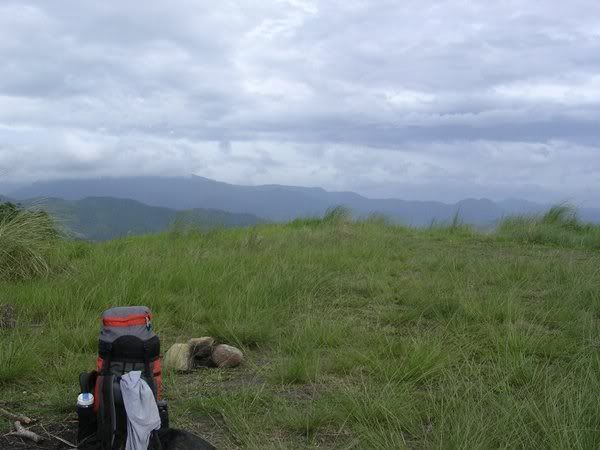
The Helipad
The campsite is dubbed as the helipad by the locals, maybe because of the wide expanse of the area which is capable of holding around 15-20 tents or more to my estimate. This is a few minutes trek from Biak na Mukha diversion, but this is going to be the most grueling 15 minutes of your trek. It was also rumored (as relayed by a local) that the ground is magnetic (maybe the magnetic attribute affects all those that have iron components in the body, including humans). Maybe it is the reason why the trail is relatively flat and just slightly slanted but trekking it is way harder than most of the assault hikes that I have encountered.
 |
| a copter can literally land here |
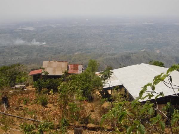 |
| several houses few meters away from campsite |
Campsite is an open-area, with a small shed on the side with the trees. Watersource is just a few minutes away, there are houses not far. I was told that the city lights is amazing to marvel at here at the helipad during a fine night, sad but I never had the chance to experience it.
 |
| just for fun:witty personal illustration of the trails |
MORE OF SIERRA MADRE (Bulacan side)
Galas Falls
A small falls with just trickling water during the dry season. This is about 15-30 minutes trek into the forest using the carabao trail. You will pass the path going down to the falls along the way, just spot the steep trail used by mag-uulings to go down. This used to be a cherry to our ice cream during our exploration climb, thinking we can camp here and have a great time enjoying the cascading waters but turns out that it is only a small one and so very far to what I had imagined.
 |
| going down the galas falls from carabao trail |
From Galas Falls, disappointed with the trickling water, we bushwacked our way to a large river, with the help of a local kid in the ulingan.
“Ipo River”
I didn’t know the name of the river, and neither did the locals. They just call it the Ilog. But remembering our location, I ascertained that we are on the direction of the Ipo Watershed and I concluded that this is the Ipo River. I have never seen such a big river as this, and it made me giddy.
 |
| May 2009:on our way to the Ipo River |
From the Galas Falls we made our way northward, traversing the trails used by the maguulings. Of course their trails are relatively hard for easy going trekker like me. So after hopping and trekking on giant boulders the trail opened up to a wide river surrounded with lush vegetation and cool air. I heard cascading waters like music to my tired body and soul.
 |
| enan cooling down the river |
Several destinations I have yet to visit:
1. Mt. Maranat and the Maranat Falls
2. Sitio Inuman
3. Mt. Oriod
4. Mt. Bituin grotto
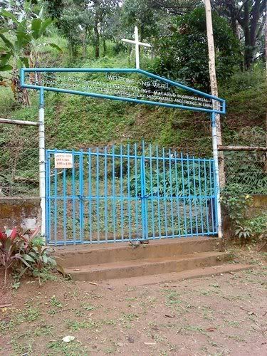 |
| gate of grotto (open on Sat to Sun 8am-4pm) |
Actual Itineraries of my Mt. Balagbag climbs:
Mt. Balagbag 1st time – March 28, 2009
0700 Board ordinary bus in Guadalupe EDSA going to Tungko (P45)
0830 ETA Jollibee Tungko; buy provisions
0930 ETD Tungko, board jeep for Licao Licao (P22)
1000 ETA jumpoff
1010 Start trek
1055 ETA 1st water falls of Kaytitinga
1125 ETA 2nd water falls of Kaytitinga
1200 ETA rough road trail
1320 ETA view deck, near the trail going to Mt. Maranat
1350 ETA Mt. Balagbag Summit
1520 Start traverse descent
1620 ETA Galas Falls entrance (we didn’t pursue the descent)
1725 ETA Sitio Karahume store, rest, and washup
1755 Start trek to main road,
1805 ETA main road, wait for jeep
1850 Ride jeep to Tungko
1920 ETA Tungko, board aircon bus to Guadalupe EDSA (P75)
 |
| @biak na mukha diversion: road to pulang lupa |
Mt.Balagbag 2nd time – April 30 to May 3, 2009
http://bundokaholics.blogspot.com/2011/04/field-report-mt-balagbag-exploration.html
 |
| from a single-room school we found during our explo |
Mt. Balagbag 3rd time – November 7, 2009
0630 Meetup Jollibee Guadalupe, bus to Tungko
0800 ETA Tungko, buy provisions, jeep to Licao Licao
0855 ETA Karahume, start trek
1230 ETA Rough road trail
1430 ETA Helipad
1630 Start descent
1900 ETA jumpoff, washup
2000 ETD Karahume
Photo 1a
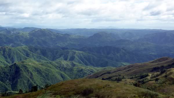 |
| panorama view of the sierra madre range |
Photocredits:
Jmazaredo
Skywalkerluke
For more information you can visit the site http://layagtrekkers.multiply.com
hits
Hi Ma'am Akyatera (c",) My name is Arvin and I am so interested in hiking Mt. Balagbag by next week. Is there a way I could contact you? Probably, via Facebook or phone perhaps? You may add me via Facebook - johnarvinramos@gmail.com. Thanks for this very comprehensive blog :-D
ReplyDeleteHi yes sir arvin, you could post in the wall or create a discussion on the FB page of this blog.
ReplyDeletehttp://www.facebook.com/pages/Akyatera-Bundokera/111783732226829
also, I think there's a recent incident in Mt. Balagbag so climbing there this time is highly discouraged.
hindi po ba advisable ngaung month sa balagbag? balak po sana namin eh... thanks.
ReplyDeleteAnyway, kung yun ang advise niyo, better follow it.
yes sir there was an incident there last May 12, a friend of mine was caught in a crossfire, his vehicle was used to bring the wounded soldier to the hospital. good thing nothing happened to him, otherwise that place might be shunned forever by the mountaineering community. sa falls sir baka ok lang magpunta pero baka hanggang Veterans area lang kayo. my friend also added that because of that incident the military decided to do an operation in the area. so more or less in the coming weeks the place will become a battlefield. not to overstate it or stuff.
ReplyDeleteme and my group are planning to do the freedom climb in mt. balagbag, sana humupa na ang gulo by next month. we're planning to take the rough road trail (in your 3rd visit) up to the helipad, we are a large group that's why we settled for mt. balagbag.
ReplyDeletehi, it is advisable that you monitor the status of the mountain. sadly, i don't have contact numbers there. maybe before the actual date of your climb, you could visit the place to do some ocular, if camping is permitted.
ReplyDeletethanks for dropping by.
hi gud pm mam,
ReplyDeletei accidentally visit your site,
do you have any info regarding mt oriod??? i have a plan po kasi for my next adventure. ito po kasi ang gusto kong targetin as of now para sa susunod kong event... if theres any pls PM me at the facebook site kindly search (asiacat_sweet7@yahoo.com) i need all the imfortant info & itinerary kung merun man..
mastsalam..
- Pusang Gala
Hi Pusang Gala, Mt. Oriod has been occupying my fantasy since time immemorial...and it had been an object of my supposed "exploration" last May 2009.
ReplyDeleteNowadays, there are groups that have summited this peak, you could inquire with Jan Layag of Layagtrekkers, or you could google and contact those UPM who recently have done an exploration with documentation. As of the moment, I have no further info besides the visuals from Mt. Balagbag. =)
BPS
goodevening po sir/ma'am..
ReplyDeletehmm.. nag hahanap po kase ako ng bundok na hindi pa po kilala, kailangn po kase nmen mag hanap ng ganon.. for our tourism planning subjct.. students lang kme from lyceum po kme..
ReplyDeletewe need to search for a place na may potential na mgng tourist spot.. kaya po as much as possible ung hindi pa po tlga kilala.. bka po may ma susuggest kayong lugar na within bulacan po.. please po we would really need your help on this, :(
kung ok lang po sa inyo pwede po tayo mag usap para po maliwanag.. 09165260509
Hi, first thing mountains are not tourist spot. Second thing I don't know any place that could be the next tourist attraction. Will text you if something came to mind. Thanks for visiting.
ReplyDeleteany place po na pwede ma-develop..
ReplyDeletehello po
ReplyDeletegusto po ng ka group ko na mag bday-climb next week,. tanong ko lang po kung merong space na pwede mag camp sa Kaytingatinga falls kc gusto po ng celebrant na malapit sa falls ang camp..
tnx...
Hi sir vladz, may flatland po sa may base ng kaytitinga. But it is a riverside so i don't advice overnight camping lalo't maulan. Siguro ok lang yung picnic then proceed to camp sa helipad na,kung pwede ng umakyat sa ngayon.
ReplyDeletegud day poh,,me and my husband were both mountaineers gsto ko snang pmunta ng mt.balagbag wid him,,laz july kc my trip cla dun ng brkada neang but i didn't allow him coz of d weather,now gsto ko sna bumawi,but the problem is i don't know how to go there,,im from valenzuela,,,can you help me
ReplyDeleteBPS, sa dami ng trails nalilito nako kung saan ba? Lahat ba sa Licao-licao ang jump off? It appears na traverse ang dapat, quick ascent using the licaolicao road trails then any trail on your descent?
ReplyDeleteIf I understand your just-for-fun map correctly, nasa gitna ng Karahume and Veterans yung falls (falls na maraming pangalan)?
Sir dun sa map, apat na trail lang. Yung tatlong leftmost is via Karahume,yung pang apat is yung via Licao Licao. Any trail Sir pwedeng ascent, any trail din pwedeng descent. Karahume is around 5 minutes away lang from Licaolicao via jeep on main road. If you have a compass, from the helipad going down, Karahume is West.
ReplyDeleteSir, may water source po ba sa campsite or san po ang may pinaka malapit na water source before reaching the campsite...?
ReplyDeleteMay water source before Campsite, a good 10-20 minute hike down. Eto yung sa registration.
ReplyDeleteAs an alternative, meron din watersource dun sa western side, yung pababa diretso ng Karahume. If on ascent to summit from Biak na Pisngi (or is that Biak na Mukha), you will see a white arrow painted on stone. Just follow the arrow and after 5-10 minutes of walking it will take you to several houses. Ang water source ko dito is yung waterhose sa mini fish pond. =)
Sir, san po ba mas maganda mag jumpoff, sa Sitio Balagbag? sa Licao-Licao or dun po sa Sitio Karahume? safe po ba umakyat ngayon dun? kahit san po bang trail jan madadaanan namin yung falls? san po kami sa tungko sakay ng jeep? salamat po ng marami!
ReplyDeleteSir, we are planning to climb Mt. Balagbag this coming weekend, hindi po ba "ligawin" ang trail? Anong trail po ba ang maii-sugest niyo na safe sa iwas ligaw? Kailangan na po ba naming komontak ng guide..? Thank you Sir.
ReplyDeleteTo address your questions:
ReplyDelete1. san po ba mas maganda mag jumpoff, sa Sitio Balagbag? sa Licao-Licao or dun po sa Sitio Karahume?
- I am not aware of a Sitio Balagbag. Mas safe at hindi ligawin yung road trail from Macabud jeep terminal. I need to update this blog to correct the term.
2. safe po ba umakyat ngayon dun?
- galing po kami last Dec 30 and safe naman po nung time namin.
3. kahit san po bang trail jan madadaanan namin yung falls?
- yung sa Karahume river trek, sa ilog ang daan nyo at yung falls ang aakyatin nyo. sa road trail naman, sasadyain nyo yung falls pababa sa mga kabahayan. me mga signs na sa road trail (from Macabud terminal) pababa ng falls.
4. san po kami sa tungko sakay ng jeep?
sa may gas station, shell yata yun. sa may dulo andun yung mga jeep. just indicate na papunta kayo ng licao licao.
magandang umaga po.. kapag sa karahume po kami nagstart (otso-ostso trail) san po kami sa karahume baba ng jeep? san po dun magpaparegister? kailangan po ba ng guide? hindi po ba ligawin yung trail? Thanks po!
ReplyDeletewe went here last Sun, Jan.22, 2012. Ang init sa trail pero panalo ang views..:).. Budget-friendly hike din..:).. I thought we went to Otso-Otso falls but upon looking at your pics Ma'am BPS, sa Kaytitinga falls pala yun..:).. At the summit, ang daming budnok na makikita.. You know kung ano po yung bundok na pag andun ka sa maliit na kubo malapit sa summit ay makikita mo agad sa harap mo? I asked one of the bikers we met pero hindi nya alam. Ang alam nya ay yung Mt. Irid and Mt. Panintingan (?) na tinuro nya yung trail. I was amazed when he mentioned those mountains and I want to try a traverse from Balagbag to Irid/ Panintingan. :)
Delete-Cory
First mam let me congratulate you on experiencing the underrated awesomeness of Mt. Balagbag. =)
ReplyDelete1. Yung Otso-otso falls is local terminology for Kaytitinga Falls. Pero more or less that Otso-otso pertains only to the lower part of the river falls where there's a large catchbasin. Yung name na Kaytitinga was coined by the group who introduced Mt. Balagbag to the hikers (Layagtrekkers).
2. That mountain is called Mt. Oriod, as I was told. But on the google map that was tagged as Mt. Maranat. I was also told in FB that Mt. Maranat was in the lower part of Mt. Oriod.
3. I heard one time about a certain Panintingan falls, and I gather this might be the same with Kaytitinga falls. I don't know about Mt. Panintingan.
4. About Mt. Irid, this one's very far, usually the jumpoff is in Sta. Ines. Several mountains had to be crossed to get there, and I don't think there's an easy traverse to that mountain.
I have read a lot bout negative things on climbing Mt. Balagbag pero good thing hindi namin na-encounter yung iba (mag uuling, etc.). Wala kaming binayad sa registration (twice on that) pero dun sa pag enter namin sa falls, nagbayad kami ng 10 petot (may mga basura na konti sa trail). What I did not want on that was when we encountered a man na na-heat stroke. Sobrang init nung pababa na kami (12nn). Nung malapit na kami sa registration na may nakalagay na "Private Property", biglang hinimatay yung lalaki. May mga locals sa registration, bout 10 meters mula kung san bumagsak yung lalaki, pero hindi nila tinulungan. Pinagtulungan ng mga kasama ko na ilagay sya sa lilim sa may registration at binigyan ng first aid. We were surprised kasi yung mga locals, pinabayaan lang nila yun. Ang comment nung isang local, baliw daw yun. After nun, bumaba na kami para sabihin sa barangay officials sa may Sitio Balagbag. Nung una, nagmamadali yung isang local na kumuha ng tricycle kasi kala nya ata kasama namin yung hinimatay. Nung tinanong na kami, sabi namin hindi namin kasama. After nun, naglakad na lang sila na parang wala lang tapos sabi sa amin "Hindi bale, hindi naman mamamatay yun". Tapos sabi nung kasama ko, "pano kuya kung syo nangyari yun tapos mauna ka?". I don't know kung ano nang nangyari dun sa na-heat stroke. Sana lang tinulungan siya.. And one more thing, yung mga bata nung makita kami, humihingi ng pagkain o pasalubong. Nagbigay kami pero konti lang. Ilang piraso lang ng tsokolate. I think that's enough kasi baka masanay yung mga bata.:)..
DeleteYup parang malayo yung Mt. Irid. But for sure, babalik ako sa Balagbag to check the trail leading to Mt. Oriod.:)..
Congrats po sa Calauitan climb nyo..:)
-Cory
Hi Ma'am BPS.. good afternoon po. Ma'am ask ko lang, Mt. Irid po yung pinakamataas na bundok na matatanaw pag nasa summit ng Mt. Balagbag at nakaharap sa may location ng Mt. Oriod? I've been researching for so long re: sa bundok na natatanaw ko dito sa office building namin sa Mandaluyong. Lam ko sa Rizal province yung bundok na nakikita ko pero di ko alam kung ano yun at kung yun ang Mt. irid.. Nakikita ko kasi yun ang pinakamataas na bundok na tanaw ko..:)..Thanks a lot..:)
ReplyDelete-Cory
Mam cory, super layo po ng Mt. Irid. General Nakar ata yan, bandang Quezon na. Yung mataas na bundok, oriod po iyan. Usually tanaw yan from MRT or from UP. Possible din na Sembrano yung bundok.
Deleteah... ganun pala.. baka nga oriod..:)..Thanks a lot po Mam..:)..
Delete-Cory
Goodevening maam, we are planning to climb Mt Balagbag this week. We're all from Malolos and all of us have no experience climbing or trekking. I've been reading your blog and some other blogs about their Balagbag adventure, I think your entry is the most detailed and reader-friendly. :)
ReplyDeleteI have a few questions btw before we climb,
this is a link to a trail map of Mt Balagbag.
http://i307.photobucket.com/albums/nn309/ipodam/balagbag-1.jpg
1) Yung jumpoff po ba sa map ay ang Karahume? leading to the otso otso falls trail?
2) Yung road po ba sa pinakababa ng map ay yung licao licao road trail?
3) Yung descent trail po ba same din ng horse/carabao trail pero iba lang ang exit?
4) Anong lugar po kaya ung may mark na EXIT sa map?
thank you very much maam.
hi po, mukhang mapa ito ni larry ng mfpi. to answer your question to my knowledge:
Delete1.mukhang hindi Karahume yan Sir, pagitan yan ng Macabud terminal at Karahume. Yung Karahume sa tingin ko is yung maraming bahay sa itaas, kung saan nagtapos yung traverse. May dinaanan ako nung unang Balagbag ko, hindi kami sa Karahume nagstart parang mga 5minutes from highway eh nag rivertrek na kami agad. Tapos saka namin nadaanan yung falls ng Karahume.
2. parang Macabud/licao licao yung nasa baba. yung parang tubo Sir, inner roads ata yan. going northeast db, yan ata yung Montalban bike trail where kakanan ka sa Biak na Mukha diversion.
3. Yung carabao trail at Rotary trail parehong Karahume ang baba nuon, magkaiba lang ng ridge na tatahakin. Mukhang yuon yung ginawang descent per map ni Sniper Larry.
4. Karahume yata yung exit Sir, mga bahay eh.
Thanks for asking,
BPS
Hello maam,
ReplyDeletethis is AnonymousMar 10, 2012 07:39 AM
Natuloy po yung Balagbag assault namin last March. Mukang karahume nga po yung Exit point sa map. We took the Karahume trail maam. Yun ang plano kaso lumagpas kami sa Karahume outpost kaya sa Licao licao terminal na kami bumaba. May nakasabay din po kaming group of around 20 plus mountaineers.Tapos sumakay po kami ng trike from licao licao hanggang dun sa street leading to the Karahume elementary school. Mula dun naglakad na po kami, sinundan na lang po namin yung grupong kasabay namin. Masaya po yung river trekking lalo na kapag nasa falls na. Dun kami nag-exit sa may pandayan ng itak,(rough road trail) kaya hindi na po namin nakita yung iba pang falls leading to veterans(tama po ba?)After nun derecho na sa helipad, took us almost 4 hours. jump-off to helipad(lol)
Talagang mainit po paakyat, lalo na kung aabutin kayo ng 12 noon dun midway.haha. Breathtaking ang view from the helipad. Nakakawala ng pagod. Registration dun sa Brgy Balagbag health center at dun sa bahay sa may Gate ng biak-na-mukha(php 10/head).
thanks po!
Woah! Thanks for the comments :) I'm now more excited for my first solo climb :) Balagbag is safe naman di ba?
ReplyDeletemaam ask ko lang po san po ba pinaka madaling trail, 1st. time sa mt. balagbag my kasama pa po kameng mga girls sila po ung concern ko best po ba sa licao licao trail,un na po ba ung pinaka madali at walang river closing??
ReplyDeletethank you in advance...
aldrin..kkclimb.
This is a very helpful post, very comprehensive, as I'm planning to climb Mt. Balagbag tomorrow, baka solo lang.
ReplyDeleteThanks a lot.
Noelizm - AKAC Group
Hi we're planning to do a night trek for Balagbag on 13-14. Easy trail ba compared to Batulao? (dun kasi kami galing last time) Ilang peaks din pala to or straight up lang ba ung trail? Safe ba na night trek?
ReplyDeleteThanks. Please text me info 09064609800
Kaga2ling lang po namin sa Mt.Balagbag khapon..narito po ang karagdagan na impormasyon:kmi po ay tga-Sucat...
ReplyDelete10am,Sumakay po kmi ng bus mula Sucat going 2 SM Fairview,P70.00 po pmsahe..12nn nkarating po kmi ng SM Fairview,dun nrin ng-lunch sa SM.1pm sumakay po kmi sa SM Fairview ng jeep pa-Tungko,P14.00 po pmasahe..lakad konti papunta sa Licao-Licao jeep terminal,P27.00 po pmasahe.pagdating dun,di na po kmi ng-tricycle.3pm na po kmi start pag-akyat,nkarating po kmi sa Helipad ng 6pm ksama pahinga at picture taking...mganda ang view sa helipad,sulit tlaga khit pawisan dhil sa sobrang init..Mawa2la ang pagod mo.. for more questions,willing po kmi sagutin... Fr:Recyl,Tinay at Nanick ng HAMOS Group(Haring Araw Mountaineers of Sucat)
nagpunta kami sa mt. balagbag yesterday lang...first timer kami lahat. 3 babae at ako lang nag iisang lalaki...mahirap pag dayhike napakainit,kaya siguraduhin nyo na nakalongsleeves kayo or protected yung skin nyo..eto sunog skin namin, kasi wala masilungan...I was a bit disappointed kasi akala ko maraming puno ..kaso kalbo na..lalo sa summit. Buti na lang may parang kubo kubohan sa tabi ng summit at duon kami kumain at pahinga konti. Kasi pag di ka sanay sa init, maheheat stroke pa.At tsaka , please bring more water,,,hehe,,,naubusan kami sa sobrang init. Pero may mga mabibili din naman don on the way...Ang kagandahan lang talaga e yung achievement na narating namin yung summit...Good luck sa next hikers!
ReplyDeleteHi po,
ReplyDeleteSino po may information para sa Licao-Licao traverse to Rodriguez?
Or better yet, sino gusto mag explore ng traverse na ito with me?
Salamat po ng napakadami!
Aldrin
Hello sir,
DeleteNa try na po namen yung Balagbag Traverse at lumabas po kame sa Montalban Rizal. Dinaanan po namen yung mga liblib na Brgy gaya ng Macaingalan at San Isidro at na explore po namen yung mga hidden falls duon. Mababait po yung mga locals at ituturo po daan senyo yung lalabas kayo ng litex.
hello po mga sir at ma'am, sino may climb this sunday July 14, 2013?..baka pwede po sumabit..
ReplyDeleteito pong blog nyo tungkol sa mount balagbag malaki po ang naitulong sa trekking namin...marami pong salamat maam.
ReplyDeleteHi.. okey or safe p din po bang akyatin ang mt. Balagbag now? Tska ano pong magandang trail ang dapat daanan para maexperince ung mga falls? Thanks so much po!
ReplyDeletepls text me para sa contact person dyan thanks po 09062189018
ReplyDeletePaano po pumunta sa otso otso falls pag galing marilao?ppunta po kasi kami sa saturday.sana may dumagit thanks.
ReplyDeletePaano po pumunta sa otso otso falls pag galing marilao? Plsss need ng sagot niyo, ppunta po kasi kami sa Saturday. Sana may sumagot thnks
ReplyDeleteIs it safe to travel alone(babae)?
ReplyDelete